
Excavation projects, whether large or small, come with a unique set of challenges and risks. One of the most critical steps that should never be overlooked is utility mapping. This process not only enhances safety but also ensures the efficiency of the excavation. In this article, we will explore the importance of utility mapping, the potential consequences of neglecting it, and the best practices for implementing it effectively.
The Importance of Utility Mapping
Understanding Utility Mapping
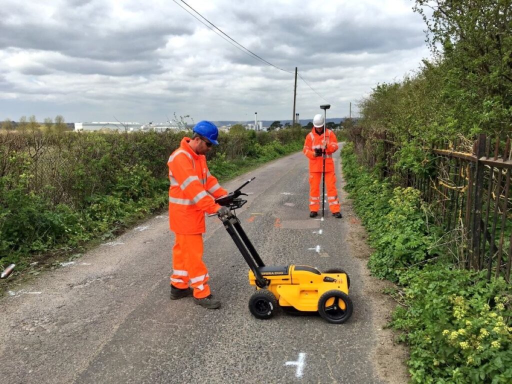
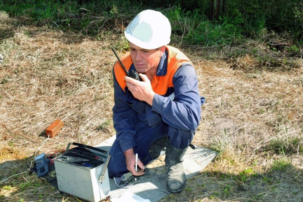
Utility mapping is the process of identifying and documenting the location of underground utilities, such as water, gas, electricity, and telecommunications. This practice is essential for any excavation project, as it provides a clear picture of what lies beneath the surface. By employing various technologies and techniques, such as ground-penetrating radar (GPR) and electromagnetic induction, utility mapping can reveal the precise locations of these utilities.
Understanding the layout of underground utilities is crucial for several reasons. First and foremost, it helps prevent accidental damage during excavation, which can lead to costly repairs and project delays. Additionally, knowing the location of utilities allows for better planning and execution of the excavation, ensuring that the project runs smoothly and efficiently. Furthermore, utility mapping can also assist in identifying the age and condition of existing utilities, which is vital for maintenance and future upgrades. This proactive approach not only saves time and money but also enhances the overall integrity of the infrastructure being worked on.
Legal and Safety Considerations
In many jurisdictions, there are legal requirements to perform utility mapping before excavation. Failing to comply with these regulations can result in significant fines and legal repercussions. Moreover, the safety of workers and the public is paramount. Striking a utility line can cause serious injuries, fatalities, and even catastrophic incidents such as explosions or flooding.
By prioritising utility mapping, project managers can mitigate these risks, ensuring a safer working environment. This not only protects the workforce but also safeguards the surrounding community, making it a responsible choice for any excavation project. Additionally, thorough utility mapping can facilitate better communication among stakeholders, including contractors, engineers, and local authorities. By sharing accurate utility data, all parties can collaborate more effectively, reducing the likelihood of misunderstandings and enhancing the overall efficiency of the project. In an era where infrastructure is increasingly under scrutiny, the importance of utility mapping cannot be overstated; it serves as a foundational element in the successful execution of any construction or excavation endeavour.
The Risks of Neglecting Utility Mapping
Potential Consequences
Neglecting utility mapping can lead to a myriad of issues that can severely impact a project. One of the most immediate consequences is the risk of damaging existing utilities. This can result in service interruptions, costly repairs, and potential legal action from utility companies. Furthermore, the project may face delays as teams work to rectify the damage caused by accidental strikes.
In addition to financial implications, there are also significant safety risks involved. Striking a gas line, for instance, can lead to explosions that endanger lives and property. Electrical lines pose similar risks, with the potential for electrocution or fires. The repercussions of such incidents extend beyond the immediate project, affecting the reputation of the contractors involved and potentially leading to increased insurance premiums.
Long-term Implications
The long-term implications of neglecting utility mapping can be equally severe. Projects that experience delays due to utility strikes may find themselves facing increased costs, which can erode profit margins. Additionally, the damage to utilities can lead to ongoing maintenance issues, further complicating future excavation or construction activities in the area.
Moreover, the lack of proper documentation regarding utility locations can create challenges for future projects. Without accurate mapping, subsequent excavations may inadvertently disrupt utilities again, leading to a cycle of damage and repair that can be both costly and frustrating. This not only affects the current project but can also deter potential investors or clients from engaging in future developments in the area, as the reputation for reliability and safety diminishes. Furthermore, local communities may suffer from prolonged disruptions to essential services, leading to public discontent and a loss of trust in the companies involved. In an age where sustainability and community engagement are paramount, the failure to consider utility mapping can have far-reaching consequences that extend well beyond the immediate financial implications.
Best Practices for Utility Mapping
Utilising Advanced Technology
To ensure accurate utility mapping, it is essential to utilise advanced technology. Ground-penetrating radar (GPR) is one of the most effective tools for detecting underground utilities. This non-invasive method uses radar pulses to image the subsurface, providing a detailed view of the utilities present. Additionally, electromagnetic induction can be employed to locate metallic utilities, offering another layer of precision.
Combining these technologies can yield comprehensive results, allowing for a thorough understanding of the underground landscape. Furthermore, employing drones equipped with mapping technology can enhance the efficiency of the utility mapping process, providing real-time data and reducing the time spent on-site. The integration of Geographic Information Systems (GIS) with these technologies can further enrich the data collected, enabling visualisation and analysis of utility networks in a spatial context. This holistic approach not only aids in identifying potential conflicts but also assists in long-term planning and management of utility assets.
Collaboration with Utility Companies
Collaboration with local utility companies is another vital aspect of effective utility mapping. These companies often have detailed records of their infrastructure and can provide invaluable insights into the location and condition of their utilities. Engaging with them early in the project can help identify potential issues and streamline the mapping process. Moreover, utility companies may also have historical data that can reveal patterns of maintenance and upgrades, which can be crucial for understanding the reliability of the existing infrastructure.
Establishing a clear line of communication with utility companies can also facilitate quicker response times in the event of an emergency. This collaborative approach not only enhances safety but also fosters positive relationships with local stakeholders, which can be beneficial for future projects. Regular meetings and updates can help maintain transparency and ensure that all parties are aligned on project goals and timelines. Such cooperation can also lead to shared resources, reducing costs and improving overall project efficiency.
Conducting Regular Updates
Utility mapping is not a one-time task; it requires regular updates to remain accurate. As new utilities are installed or existing ones are modified, it is crucial to keep mapping data current. Implementing a system for regular reviews and updates can help ensure that all stakeholders have access to the latest information, reducing the risk of errors during excavation. This proactive approach can significantly mitigate the likelihood of accidental utility strikes, which can lead to costly delays and safety hazards.
Additionally, maintaining a digital database of utility maps can streamline the process for future projects. This allows for quick access to information, enabling project managers to make informed decisions and plan effectively. Incorporating user-friendly interfaces and mobile access to these databases can further enhance usability, allowing field teams to retrieve and update information on-the-go. By fostering a culture of continuous improvement and data accuracy, organisations can better adapt to the evolving landscape of urban infrastructure and ensure the longevity of their utility mapping efforts.
Case Studies: The Benefits of Utility Mapping
Successful Projects
Several projects across Australia have demonstrated the benefits of utility mapping. For instance, a major infrastructure project in Melbourne implemented comprehensive utility mapping before excavation. By utilising GPR and collaborating with local utility companies, the project team was able to identify and avoid multiple underground utilities, resulting in a smooth excavation process and on-time project completion. Visit https://wire-cable-assembly.com/subsurface-utility-locating-protecting-your-project-from-hidden-dangers/ to get how to protect your project from hidden dangers.
This proactive approach not only saved time and money but also enhanced safety for the workers involved. The project received positive feedback from the community, highlighting the importance of responsible excavation practices. Furthermore, the successful integration of utility mapping technologies allowed the team to create a detailed digital map of the underground utilities, which can serve as a valuable resource for future projects. This level of foresight not only mitigates risks but also fosters a culture of safety and accountability within the industry.
Lessons Learned
Conversely, there have been projects that faced significant challenges due to the lack of utility mapping. A road construction project in Sydney encountered unexpected delays and costs when a water main was accidentally struck during excavation. The incident resulted in extensive repairs and a halt to the project, ultimately leading to a loss of public trust and increased scrutiny from local authorities.
These contrasting examples underscore the critical role that utility mapping plays in the success of excavation projects. By learning from both successful and unsuccessful cases, project managers can better appreciate the value of thorough planning and preparation. Additionally, the repercussions of neglecting utility mapping extend beyond immediate financial losses; they can also lead to long-term damage to relationships with stakeholders and the community. As such, investing in utility mapping not only safeguards physical assets but also nurtures a positive reputation for companies within the construction sector, reinforcing the notion that diligence in planning is paramount to sustainable development.
Conclusion
Utility mapping should be considered an essential first step before any excavation project. The benefits of this practice extend far beyond compliance with legal requirements; it enhances safety, reduces costs, and improves project efficiency. By utilising advanced technology, collaborating with utility companies, and conducting regular updates, project managers can ensure that they are well-prepared for the challenges of excavation.
Ultimately, investing in utility mapping is an investment in the success and safety of any excavation project. As the construction industry continues to evolve, embracing these best practices will not only protect workers and the community but also pave the way for more efficient and responsible excavation practices in the future.